Yes, only European cities covered by Eurostat. I tried to cover this in the about section but it basically boils down to processing time, my own available time and to a lesser extent storage.
It took me more than a week to process 2013-2023 for the included areas, which is roughly 10TB of raw imagery (with less than 60% cloud cover).
The Eurostat urban extents, for the most part, delineate urban areas with a detailed vector dataset. This is something that I also couldn’t find on a global scale.
I’m not decided yet on expanding the extents, which also depends on if people actually find this useful. However, it is open source (AGPL) so it can easily be forked and adapted.
If you’re willing to share OS/browser that could help :)
I’m on the fence with adding Sentry as I was hoping to keep the project very privacy minded.
Do you mind sharing the OS? This was developed on Firefox (Debian & iOS).
I don’t know if your WebGL is working correctly but I could try to add a check (and thus a more graceful failure mode).
Thank you for the report!
Sorry, you currently need to click to load another area. You can also navigate with the search bar or randomize by clicking the city icon.
I do want to load things automatically but need to figure out how to avoid hogging to much resources for contouring on the users device.
This is the first time sharing this, so a bit of an early release 😅
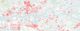
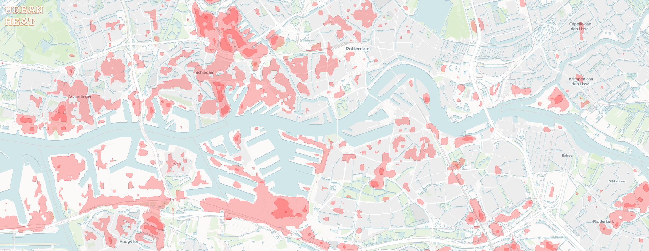
Interactive urban heat island effect visualizations for European cities.
Repo: https://github.com/damienallen/urban-heat
cross-posted from: https://programming.dev/post/14939898
> I wanted to share a small project I've been working on. The goal was to make the data from NASA's Landsat Thermal Infrared Sensor more accessible to the general public. > > I worked with the raw temperature band data to general annual maximum surface temperature raster images for large urban areas covered by the Eurostat GISCO Urban Audit. In the browser, these images are transformed into easier to interpret isotherm contours with some adjustable settings. > > I don't have a specific target audience in mind. The map could help identify areas of refuge for the warmer months, or overheated neighborhoods to avoid as we march towards a toasty future. > > Feedback is welcome :) > > > !
Interactive urban heat island effect visualizations for European cities.
repo: https://github.com/damienallen/urban-heat
cross-posted from: https://programming.dev/post/14939898
> I wanted to share a small project I've been working on. The goal was to make the data from NASA's Landsat Thermal Infrared Sensor more accessible to the general public. > > I worked with the raw temperature band data to general annual maximum surface temperature raster images for large urban areas covered by the Eurostat GISCO Urban Audit. In the browser, these images are transformed into easier to interpret isotherm contours with some adjustable settings. > > I don't have a specific target audience in mind. The map could help identify areas of refuge for the warmer months, or overheated neighborhoods to avoid as we march towards a toasty future. > > Feedback is welcome :) > > > !
I wanted to share a small project I've been working on. The goal was to make the data from NASA's Landsat Thermal Infrared Sensor more accessible to the general public.
I worked with the raw temperature band data to general annual maximum surface temperature raster images for large urban areas covered by the Eurostat GISCO Urban Audit. In the browser, these images are transformed into easier to interpret isotherm contours with some adjustable settings.
I don't have a specific target audience in mind. The map could help identify areas of refuge for the warmer months, or overheated neighborhoods to avoid as we march towards a toasty future.
Feedback is welcome :)
---
EDIT: For UK visitors, sorry to leave you with an empty map...
I've taken a look at older urban extent data and found the geometry I need to process the UK (from before leaving Eurostat). However, there are still some UI limitations to overcome since it seems that cities are split into many boroughs that could only be viewed one at a time. The reason I went with the Eurostat dataset to begin with was a nice delineation of what a city was (for the purposes of this project).
Don't have a timeline, but I do want to add the UK and automatic loading of cities as you pan!
I’m really hoping for the 3D options. If OpenSCAD isn’t a good fit then I still boot to Windows for CAD :(
I’ve had a particularly difficult time with CUDA/Pytorch in WSL. Also with Windows not reclaiming memory…
But don’t get me wrong, WSL has helped a lot when I’ve needed to use Windows at work.
In my experience:
- No lockfile, and using the third party conda-lock is clunky
- Painfully slow solver, although the libmamba solver came to the rescue
- Conda-forge can lag behind pypi by weeks, depending on the package
Interesting, but if I have to use Windows then I would consider Conda depending on my dependency situation.
I don’t particularly like Conda, or Windows, but what I like even less is manually finding wheels for my project. For something like GDAL, I wouldn’t even try on Windows without Conda. I think it’s also easy for a beginner to get up and running with this setup.
My preferred setup is pyenv on Linux with poetry :)
I remember getting a Ubuntu CD box set many years ago when I ordered free disks in the mail as a teenager. The box was well constructed, prints of high quality and the CD labels were especially sharp.
Crazy how physical media was king back then.
After getting used to the vanilla Gnome flow, at home and at work, even MacOS starts to feel a bit clunky.
Love the minimalism of Gnome with the stability of Debian.
If the open source release is adequate then you can just continue using it… Or fork for your needs.
Sadly, still dual boot for rhino, in a VM I’m just not getting enough performance out of my aging pc.
A Linux version would be a dream come true.
I like to require access to 22 via IP whitelist and all services on SSL behind a reverse proxy. Doesn’t leave much surface to attack.
FYI, you can enable a local index for message content searches:
https://proton.me/support/search-message-content#how-to-enable-search-message-content
Are you sure?
This was in the linked article:
- Caching for offline use
Same! Debian with gnome on my desktop and work laptop. Raspbian on my Pi4. Headless Debian in the cloud…
I’m also a gnome shell convert. Down with the taskbar!
You can always set watchtower to blindly pull for you. If it’s going to be broken anyways, might as well automate the process.