Geology
- Eastern Washington basalt on the Oregon Coastingallswx.com Eastern Washington basalt on the Oregon Coast
Basalt is the main bedrock of much of the Pacific Northwest, owing to the massive Columbia River basalt flows over ten million years ago. This flood basalt province erupted from numerous vents in E…
- Earthquake Early Warning System Goes Live in British Columbia!!
YouTube Video
Click to view this content.
- [GeologyHub] A Landslide Just Blocked a Major River in Canada; Now 20,000 are at Risk

YouTube Video
Click to view this content.
Please do not explore the evacuated locations and currently bare riverbed as you could be swept away without any prior warning
---
Evacuation and Affected Locations
Country: Canada Province: BC Local Regions: Chilcotin River, Fraser River
---
Additional Sources
- Biscuit Basin closed in Yellowstone National Park after massive explosion - East Idaho Newswww.eastidahonews.com WATCH: Biscuit Basin closed in Yellowstone National Park after massive explosion - East Idaho News
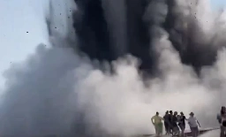
YELLOWSTONE NATIONAL PARK — Biscuit Basin at Yellowstone National Park is temporarily closed following a massive explosion that was caught on camera Tuesday morning. The “localized hydrothermal explosion” occurred near Sapphire Pool around 10:20 a.m., according to a news release from the park. Video...
- How a 7.1 magnitude deep mantle earthquake was possible July 11th 2024 Indonesia

Geology Hub: https://www.youtube.com/watch?v=LoRx-tUzbjw
Interesting description of the 3 phases involved when such deep mantle earthquakes have a theoretical limit of 3.8 magnitude.
- Foliation with slatey cleavage perpendicular to bedding

YouTube Video
Click to view this content.
Geology Professor Shawn Wilsey on location with a twisted slate rock unit in Idaho. (8:12 minutes)
https://en.wikipedia.org/wiki/Foliation_(geology)
Foliation with slatey cleavage perpendicular to bedding - Giggity Giggity
- Offshore Pacific Northwest earthquakesingallswx.com Offshore Pacific Northwest earthquakes
Frequent small and occasional medium-size earthquakes strike between 100-400 miles (160-650 km) off a section of the West Coast of North America. These occur on or near the boundary between the Pac…
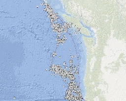
Some background on the earthquake swarm off the Vancouver Island coast.
- Veins or something else?

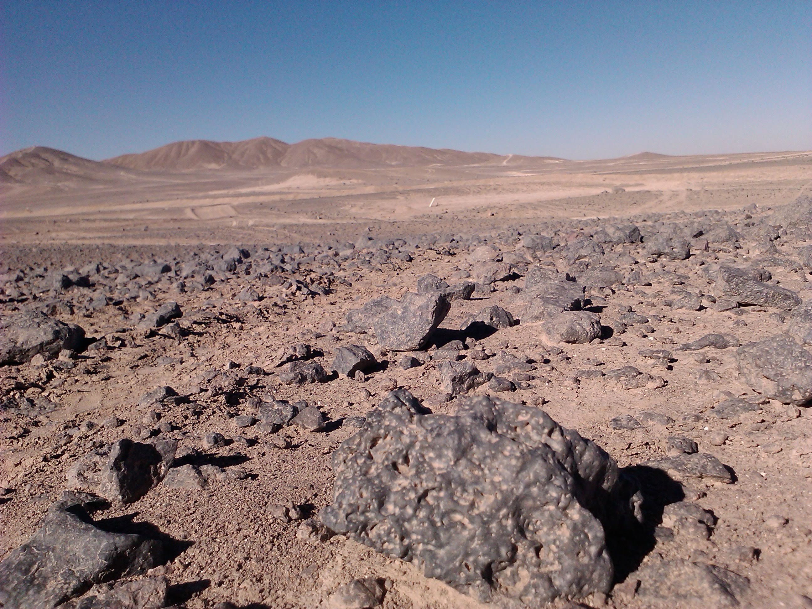
These look to me like regular intrusive iron rich veins. Boulder is about 1m across, and sandstone/mudstone, area is volcanic.
I am not a geologist.. any ideas?
- How do you polish bubbled igneous rock
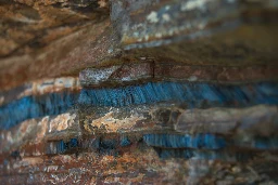
Brand new amateur collector here, I have a piece of a rock that im trying to identify that is covered in what seems to be iron, which is hiding this bright blue rock ive never seen before, however the rock is full of bubbles and is extremely jagged, is there a way to examine and polish without harming the shape
- [OC] Haughton Impact Crater, Devon Island, Canada

cross-posted from: https://lemmy.ca/post/14740589
> high arctic desert. Yes there's water, but no real vegetation.
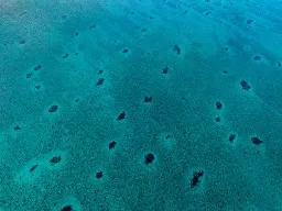
- Why Holes at the Bottom of the Ocean Disappear and Reappearwww.atlasobscura.com Why Holes at the Bottom of the Ocean Disappear and Reappear
What lurks below doesn’t always stay beneath the sand.
- Circular Sand Dunes [on Mars] | HiRise

cross-posted from: https://lemmy.ca/post/13425339
> Sauce: https://www.uahirise.org/ESP_076510_2230
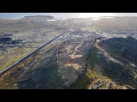
- Grindavík eruption - Þorbjörn (live feed of lava entering Icelandic town)
YouTube Video
Click to view this content.
- And Quartz, of course

Source: https://xkcd.com/2501/
Alt text: "How could anyone consider themselves a well-rounded adult without a basic understanding of silicate geochemistry? Silicates are everywhere! It's hard to throw a rock without throwing one!"
- Humans are disrupting natural 'salt cycle' on a global scale, new study shows | Phys.orgphys.org Humans are disrupting natural 'salt cycle' on a global scale, new study shows
The planet's demand for salt comes at a cost to the environment and human health, according to a new scientific review led by University of Maryland Geology Professor Sujay Kaushal. Published in the journal Nature Reviews Earth & Environment, the paper revealed that human activities are making Earth...
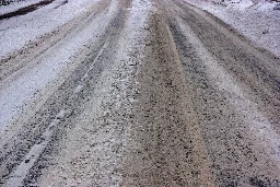
To the surprise of no environmental geo anywhere
- A lot more water is flowing through this NWT river. Why? | Cabin Radiocabinradio.ca A lot more water is flowing through this NWT river. Why?
One NWT river is behaving in a way the others aren’t, prompting scientists to ask: Where is all the water coming from? We sent a reporter with them.

- can anyone ID this deposit?

‐-----------------------‐-update 11-11‐----------------------
After more research and some lucky talks I believe this to be epidote from tailings out of the Wolverine Mine, a few miles from where I found these pieces.
‐-----------------------‐-original post------------------------
Was rock hounding on the southern shore of Lake Superior. Found these green crystal deposits that formed like geodes, specimens are small, the largest is about the size of a corn kernel. A local said it could be chlorasolite but I don't think it matches based on color and clarity. Any thoughts would be appreciated!
- Finding Argoland: How a lost continent resurfacedphys.org Finding Argoland: How a lost continent resurfaced
Geologists have long known that around 155 million years ago, a 5,000 km long piece of continent broke off western Australia and drifted away. They can see that by the 'void' it left behind: a basin hidden deep below the ocean known as the Argo Abyssal Plain. The underwater feature also lends its na...

Geologists have long known that around 155 million years ago, a 5,000 km long piece of continent broke off western Australia and drifted away. They can see that by the 'void' it left behind: a basin hidden deep below the ocean known as the Argo Abyssal Plain. The underwater feature also lends its name to the newly formed continent: Argoland. The structure of the seafloor shows that this continent must have drifted off to the northwest, and must have ended up where the islands of Southeast Asia are located today.
- What's the deepest-occurring gemstone on Earth?www.livescience.com What's the deepest-occurring gemstone on Earth?
Very few gems can withstand the intense pressure of Earth's mantle, but some require it to crystallize.

How diamonds form still isn't entirely understood, but laboratory experiments show that the gemstones crystallize only under extreme pressures. Most naturally occurring stones have been traced to the upper mantle, at depths between 93 and 186 miles (150 to 300 km), where pressures can reach beyond 20,000 atmospheres.
For a long time, this put diamonds in competition with a gem called peridot for the title of deepest-occurring gemstone. Peridot is the gem form of a mineral called olivine that makes up more than half of the upper mantle, which extends from the base of the crust down to 255 miles (410 km). But in 2016, scientists described a collection of superdeep diamonds sourced from around 410 miles (660 km), and another batch in 2021 was determined to come from a depth of 466 miles (750 km).
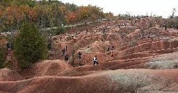
- The Cheltenham Badlands, Canada : Geology, Formationgeologyscience.com The Cheltenham Badlands, Canada : Geology, Formation
The Cheltenham Badlands, located in Ontario, Canada, is a striking and unique geographical feature that has captured the attention of locals, tourists, geologists, and nature enthusiasts alike.
- New community for the dirty people: !soilscience@slrpnk.netslrpnk.net Soil Science - SLRPNK
# Welcome to c/soilscience @ slrpunk.net [http://slrpunk.net]! > A science based community to discuss and learn all things related to soils. [https://mander.xyz/pictrs/image/611854d1-deed-41fe-94cb-6884df803eeb.png] — — ## Notice Board This is a work in progress, please don’t mind the mess. — — Subd...

cross-posted from: https://mander.xyz/post/2703469
> cross-posted from: https://mander.xyz/post/2703465 > > > cross-posted from: https://mander.xyz/post/2702615 > > > > > One stop shop for for all of your pedology needs and dank soil compass memes. > > > > > > !soilscience@slrpnk.net > > > /c/soilscience@slrpnk.net
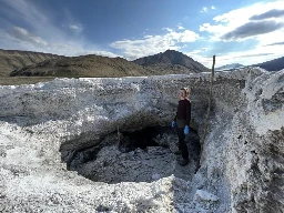
- Researchers in Nunavut to explore Mars mystery | Winnipeg Free Presswww.winnipegfreepress.com Researchers in Nunavut to explore Mars mystery
AXEL HEIBERG ISLAND, NUNAVUT – A team of researchers has travelled to a remote Arctic island in the hopes of better understanding the possibility of life on Mars. Astrobiologist Haley Sapers, a...
cross-posted from: https://lemmy.ca/post/1673900
- [OC] Haughton Impact Crater, 2010

Impact melt breccia (grey) and upthrust rocks (brown). The breccia is interesting because the melt was a carbonate. So it's sort of like a carbonatite lava.
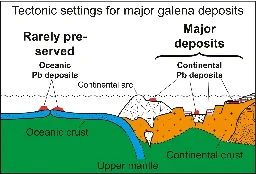
- New research dates the formation of Earth's continentsphys.org New research dates the formation of Earth's continents
Researchers at Curtin University have established a new framework for dating the Earth's evolution including the formations of continents and mineral deposits.
- Australia and Arizona rock layers
Does Arizona and Australia share the same rock formation layers? I was watching a TV show and a lot of the Australian landscaped looked very red and similar to Sedona Arizona. Do they share the same layers?
- The Anthropocene is here — and tiny Crawford Lake has been chosen as the global ground zerocanadiangeographic.ca The Anthropocene is here — and tiny Crawford Lake has been chosen as the global ground zero
Hidden beneath the surface of this Ontario lake is an archive of the earth’s history sealed in mud
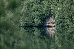
Fallout layer due to first nuclear test as horizon marker, among others
- Geologist, botanist and artist - Brian Maye on Sydney Mary Thompsonwww.irishtimes.com Geologist, botanist and artist - Brian Maye on Sydney Mary Thompson
Thompson was one of the first women to achieve distinction in the study of geology
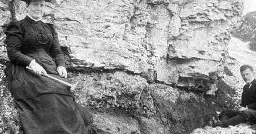
> Thompson was one of the first women to achieve distinction in the study of geology
- Brochantite micromount from a 70 year old collection

I have been working on cataloging, organizing, and photographing the micromount collection that was made for my grandfather by Don Cooke. This is a nice little (well every specimen in this collection is little) Brochantite from Eureka, Utah. The main crystal is about 2mm long. More images of the specimen can be found here: https://imgur.com/a/QGUqBfM
I will try and share some more images of the collection in the next few days.
- A gigantic landslide shows the limit to how high mountains can growwww.economist.com A gigantic landslide shows the limit to how high mountains can grow
Enough rock fell off a Himalayan peak to bury Paris to the height of the Eiffel Tower
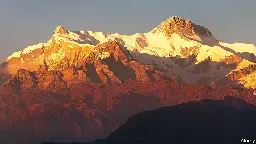
Enough rock fell off a Himalayan peak to bury Paris to the height of the Eiffel Tower
https://archive.is/oO0dC
- Deciphering the History of a Rock’s Crystallization - By combining a phase field function approach with bulk thermodynamics of mineral phases, the thermal history of a rock can now be deciphered fromeos.org Deciphering the History of a Rock’s Crystallization - Eos
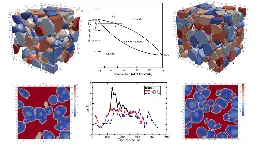
By combining a phase field function approach with bulk thermodynamics of mineral phases, the thermal history of a rock can now be deciphered from its distribution of mineral phases.
